
JACKSONVILLE, Fla. — The “Buresh Blog” will take a week off with the next update the week of June 16th. I’ll continue to update “Talking the Tropics With Mike” daily.
To become a part of the First Alert Neighborhood weather station network - scan below &/or click * here *:

The 2025 hurricane season is underway. Check out “Talking the Tropics With Mike” for daily updates about what’s up across the Atlantic Basin & all of the tropics.

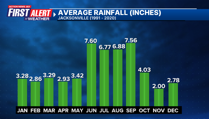
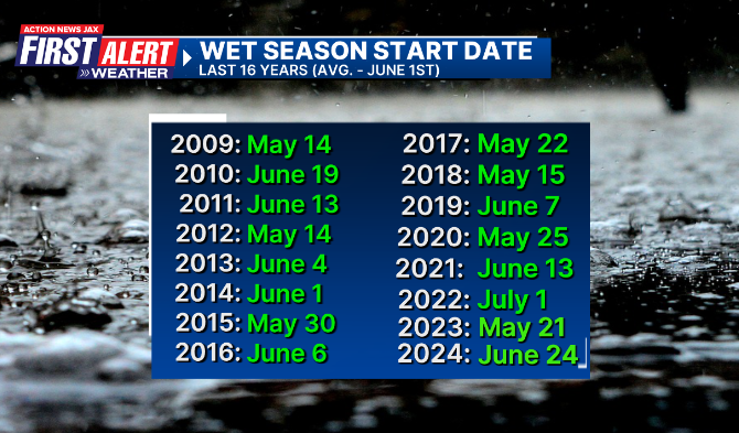
Our wet season is June, July, August & September - an average of 28.81″ of rain - & generally accounts for more than half of Jacksonville’s/NE Fl. & SE Ga. annual rainfall. I define the start of the wet season as at least 3 days in a row with more than half of NE Fl. & SE Ga. measuring rain that is not caused by a large scale system like a front or low pressure system, for example. Our wet season is driven by two main forces:
(1) the nearly daily sea breeze - either from the east coast or west coast or both. As the land heats up adjacent to the cooler ocean, a natural area of low pressure forms over land. Since air flows from high to low pressure, a sea breeze develops which acts like a front & lifts the hot, humid air creating showers & storms as the sea breeze moves inland (at least as long as the atmosphere is favorable such as high humidity & at least somewhat cooler air aloft).
(2) tropical disturbances - this could be tropical waves, tropical depressions, tropical storms or hurricanes.
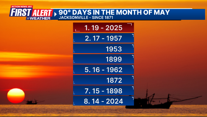
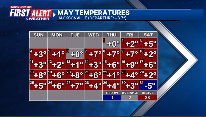
We’re coming off a very warm May - only one days was below average & not until the 31st. Jacksonville had its 5th warmest May on record (going back to 1871)... a record number of 90-degree days with 19... a record number for May - 16 - straight 90-degree days (the old record - 12 straight days in 1957)... & the highest average high temp. for May on record at 90.4 degrees. For the spring months of March, April & May, it was the second warmest on record (71.1 degrees/+2.6 degrees) for Jacksonville with the 24 90-degree days beating the old spring record of 23 days in 2011, the average is 10 days.


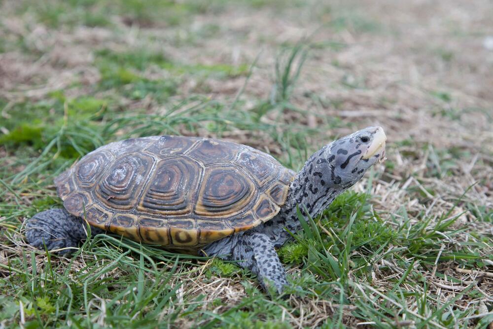
This is pretty cool - the Jekyll Island Authority launches an interactive map to track turtle activity. From GPB News: Wildlife officials have deployed an interactive dashboard with real-time maps tracking diamondback terrapin crossings and sea turtle nests on beaches. The full story is * here *.
Photo source: National Park Service
June night skies (source: Sky & Telescope):
June 9 (evening): The not-quite-full Moon is 3½° to the upper right of Antares, the Scorpion’s smoldering heart.
June 16, 17 (evening): Face west to see Mars a mere ¾° to the upper right or above Regulus.
June 19 (morning): Look low in the east to catch the waning crescent Moon and Saturn rising in tandem, 4° apart.
June 20: The longest daylight of the year in the Northern Hemisphere. Summer begins at the solstice, at 10:42 p.m. EDT (7:42 p.m. PDT).

June 20-26 (dusk): If you have an unobstructed view of the northwestern horizon, look 30-45 minutes after sunset for Mercury, just 5° to 10° high.
June 22 (morning): The waning crescent Moon and Venus rise together about 6° apart.
June 26 (dusk): Find an unobstructed western horizon to spot a slender lunar crescent 3½° to the right of Mercury, with Pollux and Castor completing a neat line to the pair’s right.
June 29 (dusk): The waxing lunar crescent hangs less than ½° to the lower left of Mars. Regulus completes the scene, shining 7° to the pair’s lower right.
Moon Phases
Full Moon June 11 3:44 a.m. EDT (Full Strawberry Moon)
Last Quarter June 18 3:19 p.m. EDT
New Moon June 25 6:32 a.m. EDT


 Sign Up

