JACKSONVILLE, Fla. — To become a part of the First Alert Neighborhood weather station network powered by Tempest - scan below &/or click * here *:

Updated every day throughout the hurricane season - “Talking the Tropics With Mike”.
We turn the calendars to September(!) on Labor Day. It’s the last month of the “wet season” & we lose nearly an hour of daylight! Averages for Jacksonville:

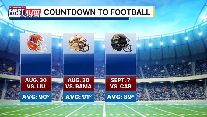
And it’s the kickoff of the football season! College FB gets underway Labor Day weekend & the Jags are just a week later:
NOAA has issued a La Nina ‘watch’ (issued when conditions are favorable for the development of El Niño or La Niña conditions within the next six months). La Nina is a cooling of the equatorial waters in the Central & Eastern Pacific. It should be stressed that climate models have moderate - at best - skill in forecasting ENSO (El Nino/Southern Oscillation) conditions. In any case... the image below already shows some hints of a weak El Nino from about 100 to 140 degrees W. A La Nina state does often correlate with more Atlantic tropical activity but it’s unclear if that will be the case this time due to the timing which is expected to be later in the season - at least Oct. if not Nov. (Atlantic hurricane continues through Nov. 30th)


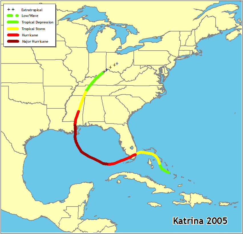
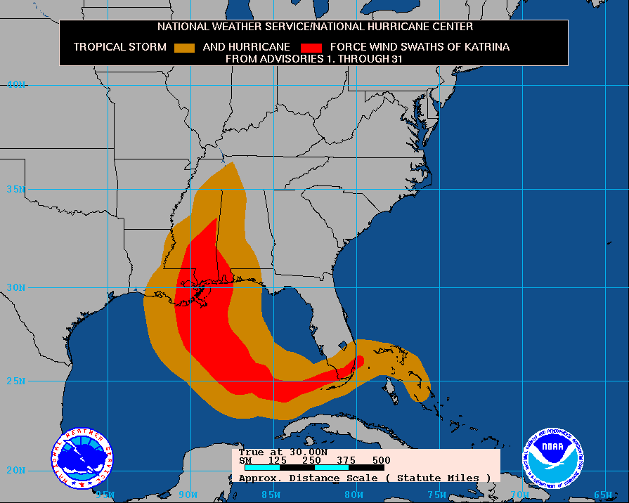
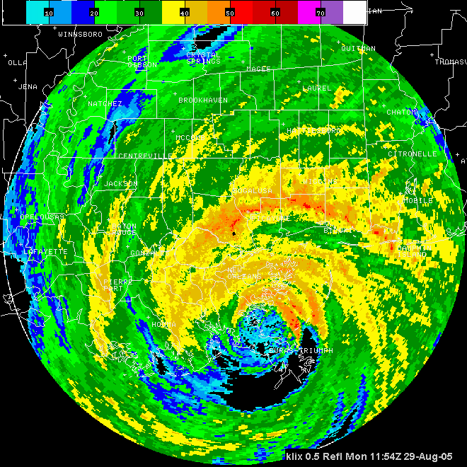
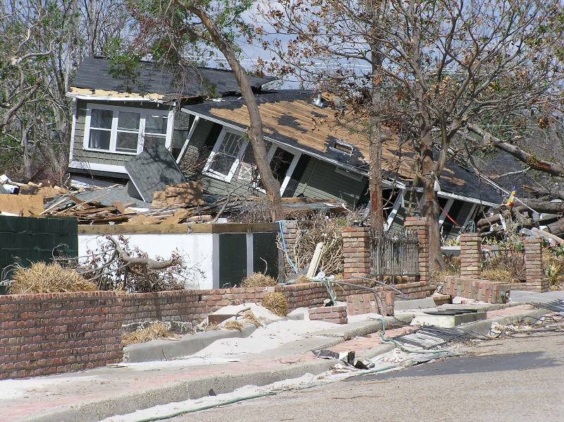
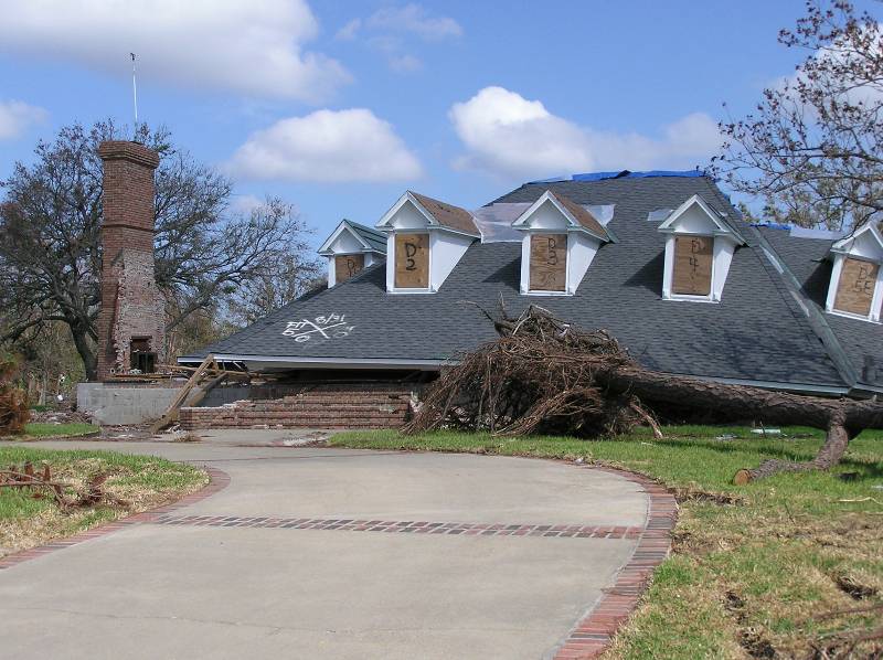
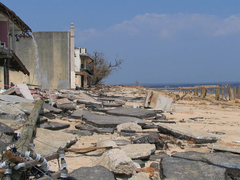
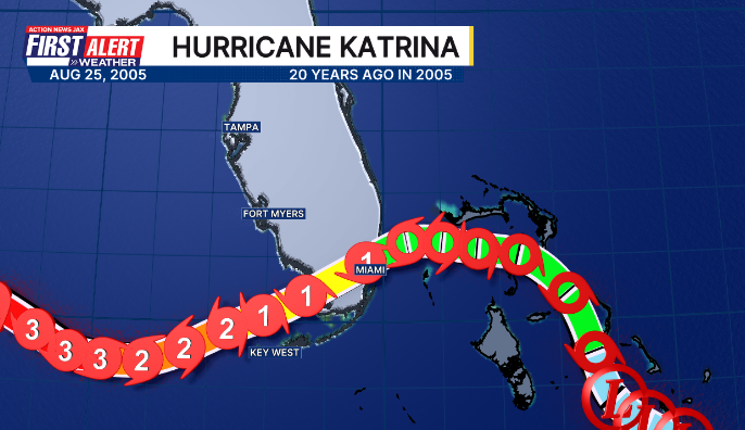
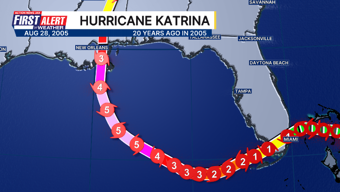
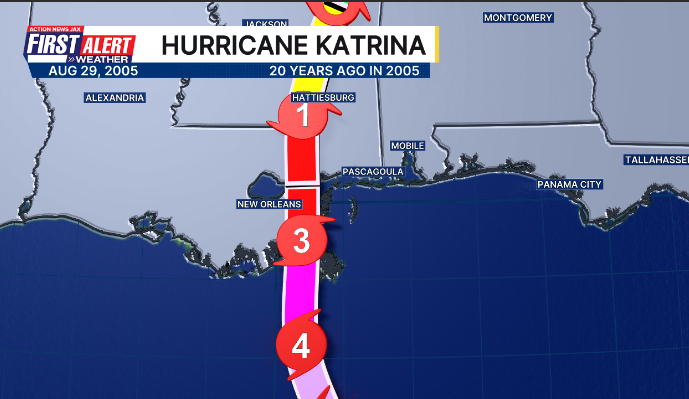
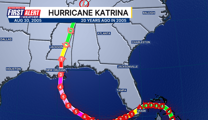
Aug. 29th marks 20 years since hurricane Katrina ravaged the Gulf Coast. Katrina first became a hurricane upon approach to the far SE Fl. coast when the eye of the then Cat. 1 moved right over the National Hurricane Center (sustained winds 69 mph, gusts to 87 mph) on Aug. 25th. Then - while moving southwest over the Southeastern Gulf - Katrina exploded into a Cat. 5. I can recall waking up early Saturday morning & being astonished at the monster in the Gulf then quickly trying to update “Talking the Tropics With Mike” (I had started the blog in late June/early July of that year). The next landfall was just east of New Orleans as an intense & - more importantly - large Cat. 3. The storm surge was extreme with as much as 30 feet of surge east of the eye that included debris from surge as far inland as I-10 in some spots! I was working here at Action News Jax at the time & can easily recall the details of forecasting the storm & its horrific landfall (there were no impacts to Jax/NE Fl./SE Ga). I’ve done follow-up reports from along the Gulf multiple times since 2005 including less than a year later, 5 years later & 10 years later. One of my stories from 2015 is below:
The New Orleans N.W.S. has a detailed post * here *... the NHC report * here *.... the Mobile N.W.S. summary * here *